When we examine trends in innovation, geospatial technology that leverages artificial intelligence, autonomous robots and augmented reality catches most of our collective attention. But widen the lens to the impact of the work we do, and the heart of the ‘why’ becomes vivid — people.
For every challenging topographic survey, mobile mapping project, and tunnel monitoring campaign, people are both the reason for and the means of geospatial innovation. They are our customers, the surveyors in the field, combining their expertise with hardware and software to work smarter, faster, safer, and cost effectively. They are the teams and crews working on all manner of surveying projects in infrastructure, construction, utilities and agriculture. They are our employees, listening to our customers, developing new workflows, and inventing the next breakthrough technology. And ultimately, they are the people living within the boundaries we survey, the drivers navigating the roads and bridges we scan, and the residents and businesses operating in the cities we measure, model and monitor.
Opportunities born of a pandemic
Despite many disruptions, the pandemic is accelerating changes long needed in the digitization of work. It has also added urgency to global infrastructure needs, deepened commitments to sustainability, and challenged us to address skills gaps across the industry. From the earliest days of COVID-19, our employees, customers, and partners showed incredible resilience in one of the most challenging periods in history. Now, two years later, they continue to stay focused on their roles as governments pour historic funding into infrastructure construction and maintenance. As a result, we are seeing an acceleration rather than a slowdown in the adoption of software and hardware solutions for the digital transformation of our key industries. Enabled by technological advances and digital transformation across all workflows, these conditions present us with a generational opportunity.
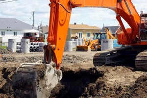
With governments putting historic funding into infrastructure, the geospatial industry is primed for innovation. In the United States, USD 550 billion is slated for new investments from the USD 1.2 trillion Infrastructure Investment and Jobs Act (IIJA) passed in November 2021. It is surveyors who will determine the location of new and existing infrastructure. To make the most of the post-pandemic era, we must enhance skills and embrace the potential of technology to advance processes across disciplines. Even the most exciting technological advances in robotics and artificial intelligence can’t make up for the need for more geospatial professionals and skilled workers to lead the industry forward.
Strengthening connected workflows
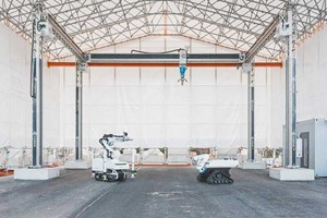
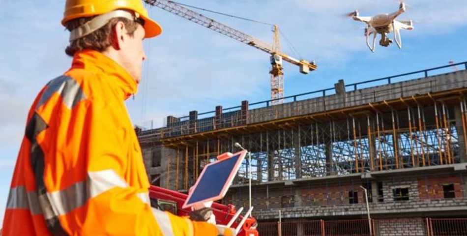
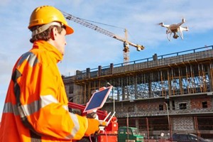
Industry platforms are driving geospatial innovation by connecting people, technology, tasks, data, processes, and industry life cycles. Cloud services enable survey companies to deliver on the Digital Twin through the software driving data capabilities. Also, changes in data collection and processing are broadening the surveyor role beyond simply capturing information in the field. Three decades ago, surveyors used either optical instruments or GNSS. Now, increasingly, they need experience in other technologies, including UAVs, scanning, and augmented reality visualization tools. Our customers also need a deeper understanding of the data, with software becoming the data hub and the place where they get what they need, when they need it. Trimble Business Center is the linchpin of our survey and mapping ecosystem. Cloud services could make it possible for a company that does airborne processing at a certain time of year to get a subscription license for a survey photogrammetry solution when it needs it.
Digital Twins are one example of innovation primed for impact from stem to stern. As the end game of scanning and mobile mapping workflows, the Digital Twin starts with the surveyor, who will capture the earth and convert it into a digital model. That model serves as a fully connected environment from which planners, designers, engineers, and workers in the field can operate in concert. This kind of digital collaboration minimizes downtime from information requests and design and stakeout updates.
Sustainable practices and impact
Ensuring a sustainable future is one of the defining issues of our generation, and current realities require even more accelerated focus and stepped-up ambitions. Geospatial technologies are addressing this need by providing sustainability benefits in land and water management and mass data solutions for Smart Cities.
Software processes and BIM/GIS integration help streamline complex project communications by ensuring a correct build the first time, which reduces rework, uses fewer materials, and generates less waste. Mapping and GIS are integral in demonstrating the environmental impact of climate change, including coastal impact, disaster mitigation, water management tools, public works projects, and endangered species mapping. With so much work related to climate change analysis, we are moving from data capture to data intelligence so we can understand and plan better for the future. And what happens with our customers also needs to happen within our own company. By weaving sustainability practices into our work both externally and internally, Trimble has increased efficiency and prevented more than 7 million metric tons of greenhouse gas emissions annually.
https://www.gwprime.geospatialworld.net/
By Ronald Bisio - Senior Vice President, Geospatial Sector, Trimble Inc.